As creatures of the 21st century, we all benefit from geographic information technology, which, among other things, provides maps to vacation spots, tracks upcoming super-storms, and offers insights into our ecosystem. In fact, gathering and analyzing geographical data is becoming increasingly essential to building a more sustainable and resilient future.
 One company developing the tools to do this is ESRI, the world leader in geographic information system (GIS) software. GIS software links geographic information (where things are) with descriptive information (what things are like). With a simple map, what you see is what you get, but with a GIS-enabled map, there are many, many layers of information that you can add to increase your understanding of that geographic space. Such understanding could lend itself in myriad ways to many different types of disciplines – health, agriculture, city management, natural resources, telecommunications, and transportation, among them.
ESRI knows just how powerful GIS can be – and has the user base to prove it. ESRI’s software product, ArcGIS™, enables organizations to utilize spatial information for analysis, understanding data, and making informed decisions. It provides data visualization for business analytics and location analytics for geographic intelligence.
More than one million people in more than 350,000 organizations use ESRI’s solutions, including most US federal agencies and national mapping agencies, all 50 US state health departments, transportation agencies, forestry companies, utilities, state and local government, schools and universities, NGOs, and commercial businesses.
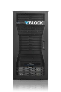
More and more each day, these organizations are utilizing GIS software for mission-critical decisions, showing the limitations of existing IT infrastructure architectures. ESRI looked to VCE to provide high value enterprise software products deployed on the Vblock Systems’ converged infrastructure. Through the benefits of application virtualization, ArcGIS desktop, mobile, and server modules are deployed much faster and can share predefined pools of virtual compute and storage resources. This provides more efficient utilization of hardware resources, easier scalability, and a more resilient platform for ArcGIS operations. As a result, ESRI customers are able to speed their path to market, improve reliability, simplify their operations, and reduce the expense associated with their core ArcGIS software deployments.
As an official reseller with VCE, ESRI’s core ArcGIS product suite can be prepackaged as an appliance on a Vblock for data centers. In addition to the standardized architecture, the Vblock provides a seamless global support and validated interoperability matrix, ensuring a highly reliable and easily scalable solution to ESRI’s ArcGIS customers.
The Vblock solution enables ArcGIS administrators to take advantage of high-class compute, storage, networking, and virtualization. Through these technologies, administrators can manage their environment with service profile templates and an automation engine that was specifically optimized for the Vblock system.
The solution greatly simplifies provisioning and configuring for ArcGIS instances on blades and servers, allowing administrators to focus on adapting ArcGIS to respond to business demands instead of infrastructure deployment.
With the expanded reseller agreement, ESRI’s customers will be better equipped to analyze and manage large quantities of data, which will enable geographical scientists, disaster recovery teams, and governments to do their jobs faster, more efficiently, and with a greater understanding of the local and global impact on the Earth.

VCE Lifecycle Assurance: Doing the Hard Work So You Don’t Have To
ESG’s July solution brief discusses how Vblock Systems from VCE aren’t just a sum of its parts, but a new way of implementing and supporting mission critical infrastructure, such as ArcGIS software. Read the brief now.